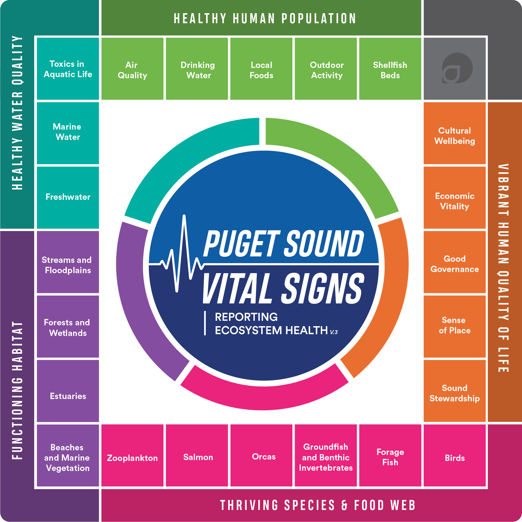
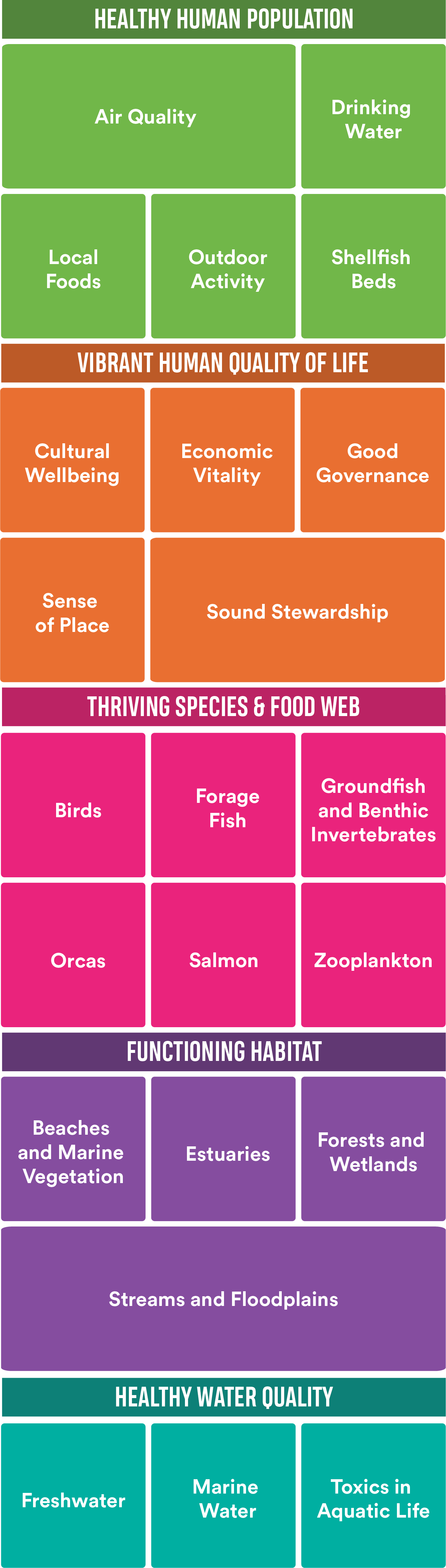
The restoration of floodplains indicator tracks the number and acreage of activities that improve floodplain connectivity and or natural land cover in the 17 major river floodplains in Puget Sound. Activity outcomes may include partial restoration (e.g., improvement), or full restoration of floodplain function. Example of an improvement is a levee breach or lowering resulting in limited floodplain connectivity with the river.
Estimated acres of floodplain restored or improved in Puget Sound's 17 major river floodplains by year. The purple line shows cumulative acres restored beginning in 2011. These data are preliminary as of 10/29/2019 and are subject to change as refinements occur. Data for 2019 are not yet complete until after the end of the calendar year.
Key Indicator Results
Though the indicator is making gains, the target of restoring floodplain function to 42,386 acres (15 percent of functionally-impaired floodplains) by 2020 is far from being met.
An estimated 188 floodplain improvement projects have been completed and improved or restored 8,162 acres (33 square kilometers).
2020 is nearly upon us; Puget Sound Partnership, WA Department of Ecology, TNC, WDFW, WDNR, and other partners will be assessing progress to date and reassessing the Floodplain indicator target for 2021 and beyond.
Contributing Partners
Recovery Target
By 2020, restore, or have projects underway to restore, 15 percent of degraded Puget Sound floodplain area.
Data Source
Washington State Recreation and Conservation Office’s Project Information System (PRISM) and partner personal communication.